Winter 2026/2027 Outlook: Super El Niño Set to Reshape Snowfall Across the US, Canada and Europe
New forecasts from the US National Weather Service and the Severe Weather Europe portal show that a rapidly strengthening Super El Niño will be the dominant force behind winter 2026/2027, likely boosting snowfall across the southern United States while leaving parts of the Pacific Northwest, the Great Lakes and northwestern Europe drier than normal.
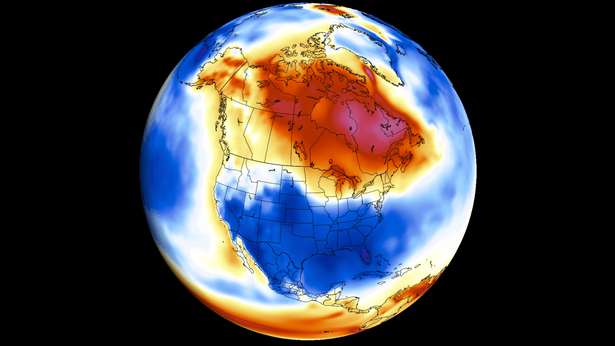
A Super El Niño takes shape
Forecasters are tracking a rapidly intensifying Super El Niño event in the tropical Pacific that is expected to be the main driver of weather patterns across North America and Europe this winter. According to Severe Weather Europe, surface ocean temperature anomalies in the ENSO region already exceed 6°C (11°F) above normal in places, while an even stronger signal lies beneath the surface: a powerful downwelling Kelvin Wave in the top 200 meters (650 ft) of the ocean, with anomalies over 9°C (16°F) above normal. This subsurface warm core is moving eastward and rising toward the surface, supplying the energy needed to keep El Niño strong through the winter.
The US National Weather Service's Climate Prediction Center (NOAA CPC) reported on September 10 that there is now a greater than 90% chance of a very strong El Niño event this fall and winter, and a 75% chance the event becomes record-setting (a three-month RONI value of 2.5°C or higher) between October and December. Sea surface temperatures in the eastern equatorial Pacific are already running more than 3°C above average.
What NOAA's official outlook shows
NOAA CPC's December–February outlook maps, released September 17, point to above-normal precipitation across the entire southern tier of the US — from coastal California through Arizona, New Mexico and Texas, along the Gulf Coast and up nearly the entire East Coast. The strongest signal, 70 to 80%, covers southern Georgia and northern Florida, though temperatures there are expected to be near normal, making rain rather than snow the likely outcome. In the mountains — Utah's Wasatch, Colorado's San Juans, and the high country of Arizona and New Mexico — temperatures are shown as "equal chances" with no lean toward warm or cold, meaning the added moisture could still build meaningful snowpack. By contrast, the Pacific Northwest, the northern Rockies, and the Great Lakes region, including Michigan, are shaded both dry and warm — the areas most associated with classic snowy winters. The northern Plains, the Dakotas, and the Ohio and Tennessee valleys show no clear signal in either direction.
Lessons from past events, and Europe's outlook
Severe Weather Europe notes that in past strong El Niño winters, above-normal US snowfall favored the Sierra Nevada, the Four Corners, the Southern Rockies, and parts of the Central Plains and the South, while the Pacific Northwest, the Great Lakes and the Northeast typically saw deficits. In Europe, strong El Niño winters have historically brought below-normal snowfall to the northwest, south, and north-central regions, driven by a mild westerly Atlantic flow and a rising southern ridge.
Compared with the August 20 outlook, the new NOAA maps raise the precipitation probability over southern Georgia and northern Florida and expand the wet signal across California and into the Sierra. The next NOAA update is due October 15.