Google retracts AI tool in Google Earth that made fake satellite images
Google has removed an AI feature in Google Earth that allowed users to generate or alter satellite imagery, after experts warned about misinformation risks and verification shortcomings. The company says the feature may return once stronger safeguards are implemented.
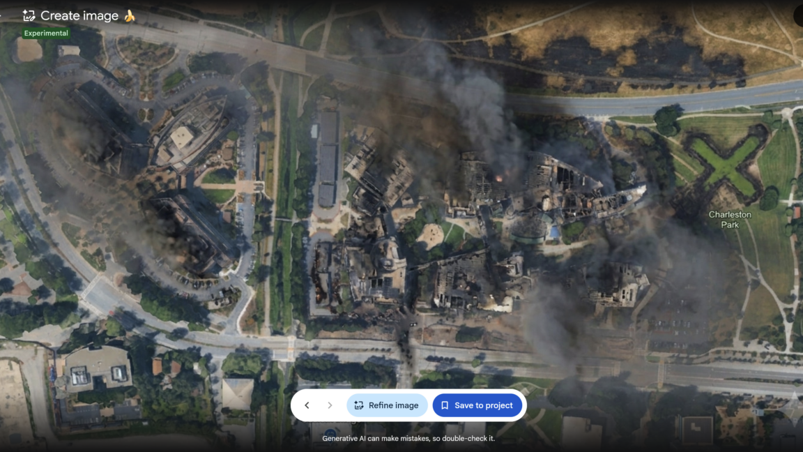
Google has rolled back an AI-powered tool in Google Earth that let users create or modify satellite images. The company cited policy violations after people shared screenshots of generated imagery, and said it is working on stronger guardrails before potentially reintroducing the feature.
Before the removal, Ars Technica tested the feature alongside Google's SynthID watermarking system. Earlier tests had shown that SynthID watermarks survive heavy edits and data loss, but the system is limited to roughly ten image checks per day. When Ars asked Google's Gemini assistant to run SynthID checks on several AI-modified images created in Google Earth, Gemini detected digital watermarking indicating the images had been generated or edited with Google AI tools.
However, security researcher Ess raised doubts about relying primarily on SynthID and Google's verification tools. He questioned why Google's policy on preventing AI-generated images about harmful topics did not stop the creation of a scene like a hospital with a bomb crater in Gaza. He emphasized that fakes seldom travel as clean files with intact credentials; instead, they spread as screen recordings, re-encoded clips, screenshots of screenshots, or hurried photos taken of another screen.
That concern was validated when Ars photographed an AI-altered image from the feature using a smartphone camera, and SynthID could not provide any verification. Ess warned that embedding an AI image generator in Google Earth risks undermining public trust in the platform as a reliable reference for authentic imagery of the real world. It could also give government officials or anyone else an excuse to deny genuine satellite photos by claiming they were modified or generated by AI, making it harder for journalists and researchers to counter misinformation.
Ess recommended verifying satellite imagery through multiple sources and relying on constantly updated data, such as Europe's Copernicus Sentinel-2. Google's statement acknowledged the misuse and the need for stronger defenses, while leaving open the possibility of bringing the feature back in the future.
/nginx/o/2026/09/29/17944469t1h1037.jpg)
