SkyeBrowse Measures Roofs and Flags Hail Damage From a Single Drone Flight
SkyeBrowse, a drone-based 3D modelling software company, released a tool on November 5 that measures a roof and screens it for storm damage from one drone flight. An inspector approves or rejects each AI finding.
SkyeBrowse, a U.S. company that builds 3D models from drone footage, released a tool called Roof Damage Analysis on Thursday, November 5. It measures a roof and screens it for storm damage using a single drone flight. The company aims it at roofing contractors and insurance adjusters, trades outside its usual base of public safety agencies.
Measurements and the AI scan
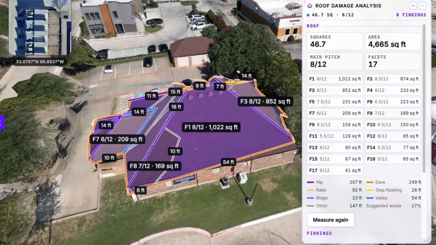
On the finished 3D model, the tool finds the roof, outlines each facet and reports area, pitch, and the lengths of ridges, hips, valleys, eaves and rakes. On a commercial building in the demonstration, it found 17 facets over 4,665 square feet (433 square meters) at an 8/12 main pitch.
An AI scan then reviews up to 16 flight frames and 8 gallery photos in about 20 seconds, marking each finding as Likely or Possible. It looks for items such as hail hits, wind creases, lifted shingles and torn membranes. The inspector approves or rejects every finding, and only approved ones reach the PDF report. SkyeBrowse calls the scan a screening aid that does not determine cause, coverage or repair scope.
Date of loss and maps
The Weather tab pulls the nearest hail report within 25 miles (40 kilometers) from the Storm Prediction Center and suggests it as the date of loss. The U.S. National Oceanic and Atmospheric Administration (NOAA) labels these reports preliminary.
The same release adds a 2D map export for SARTopo and ArcGIS, a contour DXF file, and model correction using ground control points.
The tool is available on SkyeBrowse Pro at $49.99 per model, or $39.99 with annual billing, and on the Public Safety & Enterprise plan.